
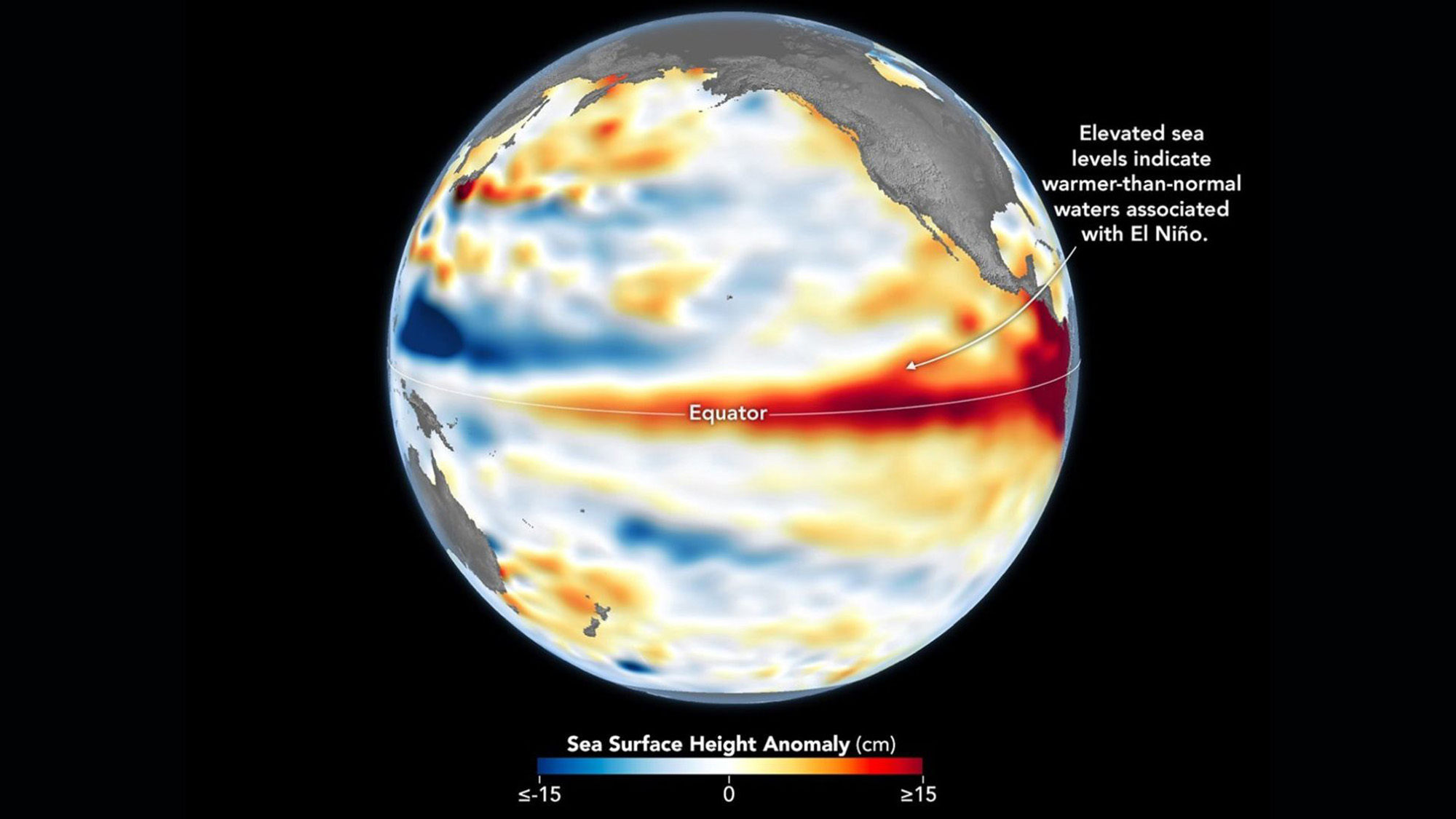
A wave of warm water and higher-than-usual sea surfaces (red) stretches across the Pacific, a few days before El Niño was declared.
(Image credit: Data for the map were acquired by the Sentinel-6 Michael Freilich satellite and processed by scientists at NASA’s Jet Propulsion Laboratory (JPL).NASA Earth Observatory/Lauren Dauphin)
A massive wave of warm water is making its way across the Pacific Ocean as the newly declared El Niño gets into full swing, satellite images show.
The band, called a Kelvin wave, marks a swell of higher-than-average sea levels that stretches hundreds of miles along the equator. The anomaly is caused by warmer waters linked to El Niño — the warm phase of a natural climate pattern whose current iteration could become one of the strongest ever recorded.

Skyler Ware is a freelance science journalist covering chemistry, biology, paleontology and Earth science. She was a 2023 AAAS Mass Media Science and Engineering Fellow at Science News. Her work has also appeared in Science News Explores, ZME Science and Chembites, among others. Skyler has a Ph.D. in chemistry from Caltech.
” data-join-the-conversation-text=”Join the Conversation”>
You must confirm your public display name before commenting
Please logout and then login again, you will then be prompted to enter your display name.
